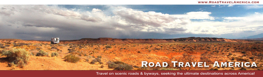
Travel Guide to the Burr Trail Scenic Backway in Utah
Outdoor enthusiasts in Utah have lots of great questions, like "Where is the famous Burr Trail ?"
The Burr Trail takes the adventurous traveler into some of Utah's most beautiful and extraordinary country, with views of the Henry Mountains, the colorfully contorted Waterpocket Fold, red Circle Cliffs, and Long Canyon.
The road connects the town of Boulder with Bullfrog, and passes through the painted rock country of Glen Canyon National Recreation Area, Capitol Reef National Park, and Grand Staircase-Escalante National Monument land.
Are there really switchbacks along the Burr Trail?
The famous Burr Trail switchbacks rise steeply up through the canyon. The trail drops nearly 800 feet in about a mile, while zigging and zagging down the Waterpocket Fold.
What will I experience when driving the Burr Trail?
Various vista points along this backway offer thrilling views of sprawling scenery of buttes, mesas, plateaus and mountain peaks. The Burr Trail connects with Highway 276, just north of Bullfrog Marina on Lake Powell.
Waterpocket Fold is a colorful eroded fold of rock layers nearly 100 miles long but only a few miles wide. In Burr Canyon, the Navajo sandstone has been completely eroded away, leaving a huge notch in the Waterpocket Fold.
More About the Burr Trail
The Trail, which ends (or begins) at Boulder, Utah, is one of our favorite back roads in the country. We have driven it several times, sometimes in a 4x4 Jeep, other times in a 2WD Toyota 4Runner.
On Utah Scenic Byway 12 is located the small community of Boulder, 32 miles north of the town of Escalante, and 40 miles south of Torrey.
It is typically quiet, with little or no traffic. In earlier years the entire length of the road was dirt; today parts are paved. The drive and views are stunning! The switchbacks are breathtaking!
Numerous hikes and side trips are available for those with the time and inclination.
Although in dry weather the Burr Trail is easily accessible in passenger cars, wet weather may make the road impassable even for 4WD vehicles. Recreational vehicles are not recommended.
County officials decided to pave the road from Boulder to the Capitol Reef National Park boundary a few years ago.
Driving the dirt and gravel section of the Burr Trail, experiencing some washboarding, on the way to the switchbacks

Burr Trail Switchbacks
Originally, only the switchbacks were named the Burr Trail, a route used by cattlemen in the late 19th century to move cattle back and forth between winter and summer ranges. Today, the entire road from Bullfrog to Boulder is known as the Burr Trail, named after John Atlantic Burr, a local cattleman.
Map of the Burr Trail Switchbacks

Aerial view of the Burr Trail Switchbacks
(Photo courtesy of BoulderUtah.com)

Getting ready to drive the rapid descent on the
switchbacks on the Burr Trail in Utah

Driving the steep switchbacks down the Burr Trail in Utah
... all hands on the wheel!

View to the valley from part way down
the switchbacks down the Burr Trail
 |
Burr Trail Driving Times and DistancesDriving time from Bullfrog Visitor Center to Boulder is about 2 hours, while continuing on to the Escalante Visitor Center will make the total trip about 3 hours. The trip can take longer depending on how many stops are made along the way. Part of the trail is paved, the unpaved part is accessible via a typical passenger car most times of the year. |
Stopping to enjoy the solitude on the Burr Trail
|

Lodging in and Around Boulder, Utah
We have stayed at the Boulder Mountain Lodge during our trips to the area. It offers a variety of rooms and suites, on two floors. It is located at the head of the Burr Trail, at 20 North Highway 12 in Boulder. Phone 435.335.7460.
On the beautiful grounds is a pond, the well known and highly respected Hell's Backbone Grill, and an excellent gift shop.
On other trips to Boulder we have stayed at Pole's Place Motel located at 465 North Highway 12, across from Anasazi State Park. It was founded by Eugene Napoleon "Pole" Griffin, and is today owned by a fourth-generation Boulder family. The motel is small, clean and quiet, with free parking right outside your door. Phone 435.335.7422.
Other lodging and B&Bs are also available in the area. Several dining options are available including the Burr Trail Grill and Burr Trail Outpost, as well as the Hell's Backbone Grill and others.
Driving the Burr Trail and staying in Boulder? Read Boulder lodging reviews, check availability and make reservations via TripAdvisor
|
The Boulder Mountain Lodge and Hell's Backbone Grill on Highway 12 in Boulder, Utah |

Map of the Burr Trail from Boulder to Bullfrog, Utah (Courtesy of National Park Service)

Interactive Map of the Burr Trail and Boulder, Utah Area
Photographs Along the Burr Trail
Burr Trail in Utah ... 11 Miles to Capitol Reef, 52 Miles to Bullfrog Marina
 |
Still on the paved section of Burr Trail  |
The red rocks along the Burr Trail |
Entering Capitol Reef NP in Utah |
Dusty day in the 4x4 on Burr Trail |
Close-up of the various colors of rock along the Burr Trail

Brilliant blue skies as a backdrop to the red cliffs along the Burr Trail |
Time for rapid descent along the Burr Trail, still on the paved section |
Ferry to BullfrogState Route 276 runs through the Glen Canyon National Recreation Area and crosses Lake Powell via the Charles Hall Ferry. Travel time over the water takes approximately 25 minutes. This does not include loading, unloading, and travel times on roads within the park. |
Riding the ferry at Bullfrog at the end of the Burr Trail
The ferry's southern port is at Hall's Crossing and the northern port is at Bullfrog. |

Photographs Around Boulder, Utah
Utah Scenic Byway 12 ... All-American Road

Utah Scenic Byway 12 between Escalante and Boulder, Utah

Quick Trip Along the Burr Trail!
We've prepared this short, 4-minute video about the Burr Trail ... sit back and enjoy ... and turn up your volume for some easy-listening music!
Like all YouTube videos, you can click to run it full screen, and mute the music if you like.
More Information About the Burr Trail
Burr Trail on the Glen Canyon National Recreation area official website at NPS
Burr Trail at the ScenicByway12.com website
Boulder on VisitUtah.com website
Read more about the community of Boulder Utah on this website
Want to Drive More Switchbacks in Utah?The Moki Dugway is a steep, gravel three mile road located in southeastern Utah, traversing 1,200 feet from the top of Cedar Mesa to the broad valley below. The road is actually part of Utah Highway 261, most of which is paved. The gravel section of 261, the Moki Dugway, is well maintained and open all year, but road closures can occur, so be sure to check conditions before traveling to this area. |
Aerial view of the Moki Dugway in Utah, seen from the top of Cedar Mesa, with the Valley of the Gods below
|
