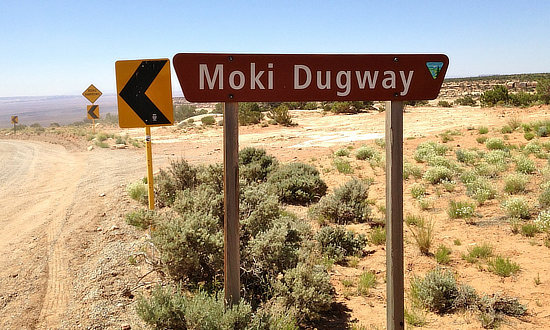
Driving the Moki Dugway in Utah in 2026
Off-road enthusiasts often ask "Where is the Moki Dugway, and is it dangerous?"
The Moki Dugway is a steep, gravel three mile road located in southeastern Utah, traversing 1,200 feet from the top of Cedar Mesa to the broad valley below. The road is actually part of Utah Highway 261, most of which is paved.
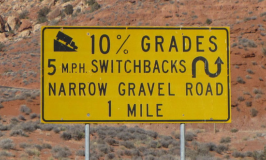 What to expect on the Moki Dugway ... 10% Grades ... 5mph Switchbacks ... Narrow Gravel Road |
We have driven the Moki on numerous occasions ... it is not for the faint-hearted, but at a slow speed it is a fun, exhilarating trip! It's a relatively easy gravel road to drive if one drives slow and carefully, and is aware of weather and road conditions. But if you are prone to a fear of heights or have vertigo, you might want to chose alternate routes in this area.
The first time we drove the Moki, it was an unexpected situation. We were driving on a road trip from Arches National Park near Moab to Monument Valley Navajo Tribal Park on the Utah-Arizona border, and didn't know about the switchbacks, and were surprised when Utah 261 turned to gravel.
Road Conditions and Vehicle Recommendations
Utah 261 is part of the Trail of Ancients, a National Scenic Byway that stretches across 480 miles through Colorado and Utah. The highway connects Utah Highway 95 with US Highway 163 by crossing Cedar Mesa and plunging down the dugway at an 10% grade, revealing sweeping views of Valley of the Gods, stripes of color in the rocks of the San Juan River Canyon known as the Navajo Tapestry, and distant Monument Valley. Allow 1 hour travel time for the entire length of Utah Highway 261.
The gravel section of 261, the Moki Dugway, is well maintained and open all year, but road closures can occur, so be sure to check conditions before traveling to this area. During and after a rain or snow storm, the road may be impassable, even with a four-wheel-drive vehicle and can easily get muddy if it rains making it challenging to get through.
 Map showing the Muley Point Road from Utah 261 |
The State of Utah recommends that only vehicles less than 28 feet in length and 10,000 pounds in weight attempt to negotiate the road. Most vehicles can travel the route safely. Caution is advised for motor homes or vehicles pulling trailers. However, small RVs like truck campers and shorter class B and class C motorhomes can navigate the Moki with careful driving.
Moki Dugway History and Background
Moki is derived from the Spanish word, Moqui, a general term used by explorers in this region to describe the Pueblo Indians they encountered as well as the vanished Anasazi culture. Dugways are roads chiseled into steep slopes.
Even today, hand-carved hand and foot-holds and worn step-like paths of ancient American Indians can be found leading up cliffs and steep escarpments to food storage areas, dwellings, springs, or up steep escarpments like Cedar Mesa.
The Moki Dugway was constructed by the Texas Zinc Minerals company in 1958 for trucks to haul uranium and vanadium ore from the Happy Jack Mine on Cedar Mesa to the mill in Halchita, near Mexican Hat.
Muley Point Overlook
The Muley Point Overlook is located at the top of Cedar Mesa, about 4 miles off Highway 261. It provides visitors with a panorama views of the Valley of the Gods, Monument Valley, the San Juan River Canyon, the Sleeping Ute Mountain in Colorado, and Shiprock in New Mexico. As you enter the Moki Dugway heading south, take the dirt road on your right and drive along Muley Point Road to the overlook.
Distances from Area Cities and Towns to Moki Dugway
- Mexican Hat: 11 miles/18 km - From Mexican Hat, drive northeast on US Highway 163 to the junction with Utah Highway 261. At that junction turn north or left onto 261. Follow 261 to the base of the cliff and begin climbing the Dugway.
- Bluff: 28 miles/45 km
- Monument Valley: 34 miles/55 km
- Blanding: 54 miles/ 87 km
- Monticello: 75 miles/121 km
- La Sal: 115 miles/ 185 km
| Aerial view of the Moki Dugway in Utah, seen from the top of Cedar Mesa, with the Valley of the Gods below (BLM Photo) |
 |
Moki Dugway Map
|
| Approaching Cedar Mesa and the Moki Dugway heading north on Utah Highway 261 10% Grades ... 5mph Switchbacks ... Narrow Gravel Road Next 3 Miles |
 |
Quick overhead video of a drive on the Moki Dugway (0:31)
(Courtesy of the Utah's Canyon Country - San Juan County Economic Development & Visitor Service)
Driving the Moki Dugway southbound ... in HyperLapse mode (3:00)
Want to Drive More Switchbacks in Utah?
 |
On Utah Scenic Byway 12 is located the small community of Boulder, 32 miles north of the town of Escalante, and 40 miles south of Torrey.
The Burr Trail, which ends (or begins) at Boulder, Utah, is one of our favorite back roads in the country. We have driven it several times, sometimes in a 4x4 Jeep, other times in a 2WD Toyota 4Runner.
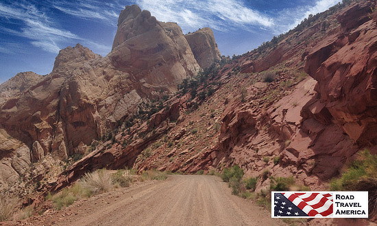
It is typically quiet, with little or no traffic. In earlier years the entire length of the road was dirt; today parts are paved. The drive and views are stunning! The trail drops 800 feet in a short distance via a series of sharp switchbacks to the valley below!
| Driving the steep switchbacks down the Burr Trail in Utah
... all hands on the wheel! |
 |
Lodging in the Four Corners Area |
|
 |
|
More Attractions in the Moki Dugway Area |
||||||
|
||||||
